

To view available Geography PhD Dissertations and Master Theses.
To view available Planning PhD Dissertations and Master Theses.
TSpace is a free and secure research repository established by University of Toronto Libraries to disseminate and preserve the scholarly record of the University of Toronto community, including faculty and graduate student research. All items in TSpace are openly accessible, either immediately or after publisher's embargo period.
Examples of Recent Geography PhD Dissertations and Master Theses
Leclair, Kamille
Advisor: Farber, Steven
Department: Geography
Keywords: Applied Research; Asset Management; Infrastructure; Project Prioritization; Social Equity; Transportation Planning
Issue Date: Nov-2022
Abstract (summary): This project stems from an applied research partnership between the University of Toronto and the City of Toronto. Over an 18-month period, our team designed a web-based tool to help managers at the Transportation Services Division assess the equity performance of infrastructure projects under their care. The tool’s output is a quantitative score which is based both on the demographic profile of those who live around the project location and on the anticipated impacts of the project. The main goal of this master’s thesis is to explain the scoring protocol we developed and to demonstrate how the tool can be used in practice to inform decision-making. As the City of Toronto faces a major budget shortfall, this new tool shows great promise to support equity-oriented project prioritization. More broadly, we hope that reporting our experience will prompt other cities to make equity an integral part of their infrastructure planning and delivery process.
Tabascio, Alexander
Advisor: Farber, Steven
Higgins, Christopher
Department: Geography
Keywords: Bus Prioritization; Equity-Seeking Transit Riders; Service Planning; Toronto; Transit Equity; Transport Poverty
Issue Date: Nov-2022
Abstract (summary): In December of 2019, the Toronto Transit Commission proposed a new equity service policy to provide improved bus service for low socio-economic neighbourhoods in Toronto. While this policy will provide enhanced service for individuals within these communities, methods and data constraints may exclude equity-seeking riders outside these areas promoting greater barriers to access. With this concern in mind, this thesis aims to thoroughly examine the proposed equity policy using quantitative methods and provide recommendations that remove further barriers to transport poverty and transport-related social exclusion.
Yee, Katherine
Advisor: Daigle, Michelle
Department: Geography
Keywords: Indigenous futurities; Indigenous resurgence; Indigenous studies; kincentric ecologies; land-based practices; urban parks
Issue Date: Nov-2022
Abstract (summary): This thesis is an exploration of colonial dispossession within cities and specifically urban parks recognizing all parks in so-called Canada exist on the traditional territories of Indigenous peoples. Within this thesis I utilize mixed methods, first conceptual analysis is used to discuss the structural-materialist emergence of urban parks as colonial spaces. Secondly, drawing from my own embodied experience earthworking with Two-Spirit Indigiqueer community in High Park, Tkaronto, I engage with land-based theoretical frameworks including land as pedagogy, kincentric ecologies, and reciprocal restoration to story ongoing Indigenous resurgence and futurities. This research considers the colonization of urban parks, and the possibilities and need for improved access for urban Indigenous peoples to engage in land-based practices. I argue, Indigenous inclusion within urban parks, at various levels, is required for the future ecological sustainability of parks and to create safe and accessible spaces for urban Indigenous peoples to enact land-based cultural practices.
Nitsis, Christina
Advisor: Maclaren, Virginia
Department: Geography
Keywords: Circular economy; Refill; Reuse; Waste
Issue Date: Nov-2022
Abstract (summary): As a reuse-based system, refills offer a starting point in reducing packaging waste and shifting our capitalist, linear economies towards more circular approaches. The concept of ‘refilling’ has been present since the advent of milk delivery services (Vaughan et al., 2007), however the study of what a refill is, and how it works in practice, is insufficiently understood. The purpose of my research is to fill this gap in understanding by investigating the motivations and challenges faced by retailers who offer refills of household and personal care products in a case study of Ontario. This qualitative study involved one-on-one, semi-structured interviews (n=23) with refill-based retailers across Ontario. Key findings include challenges such as customer education and recruitment, COVID-19 and having to ‘do it all alone’, and motivations, including environmental motivations. The implications of this study reveal that further research is needed on the accessibility of refills, and their economic and environmental viability.
Zuo, Xiaomeng
Advisor: Brown, Laura C
Department: Geography
Keywords: Canadian Arctic; Cyclones; Large-scale oscillations; Precipitation; Trends
Issue Date: Nov-2022
Abstract (summary): A trend analysis of the Arctic System Reanalysis Version 2 (ASRv2) data from 2000 to 2015 showed that changes occurring with summer rainfall and snowfall are synchronized in the Canadian Arctic. The precipitation distribution in the Canadian Arctic with the low-pressure system (center pressure < 1000hPa) patterns showed high consistency; however, snowfall in areas including Ellesmere Island and northeastern mainland NU was not found to be related to the cyclone distribution. The influences of the summer Arctic Oscillation (AO) and North Atlantic Oscillation (NAO) on the cyclones vary regionally, leading to a complicated distribution pattern of rainfall and snowfall. These variations might also be related to sea ice opening and local evaporation, in addition to the moving jet stream. Under the circumstances of global warming and Arctic amplification, changes in summer precipitation might have substantial impacts on the hydrology, sea ice, and permafrost conditions in the Canadian Arctic.
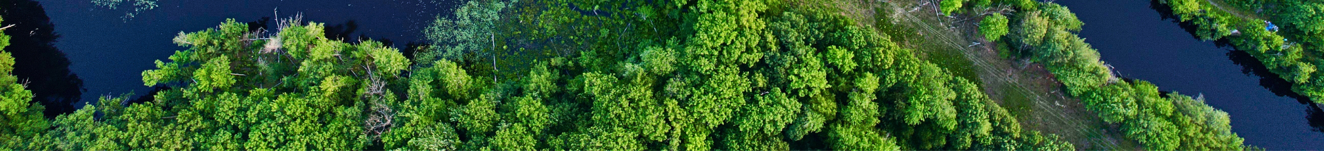
Bonney, Mitchell Thurston
Advisor: He, Yuhong
Department: Geography
Keywords: Aerial photography; Landsat; Suburbanization; Time-series; Urban forests; Vegetation change
Issue Date: Nov-2022
Abstract (summary): Forests, especially in urban and surrounding landscapes, are important natural resources that provide environmental, climatic, economic, social, health, and aesthetic benefits. It is thus important to continuously monitor these forests, which may grow, shrink, or be otherwise impacted by abrupt or gradual changes from many drivers. Long-term remote sensing time-series represent the only means by which the spatio-temporal dynamics of these forests can be consistently collected since the mid-1900s. Aerial photography provides the longest temporal coverage and can observe individual trees, but is limited in temporal density, in spectral coverage, and by differences in photograph technology through time. Landsat satellites with medium spatial resolution cannot observe individual trees but, with recent advances in sensor harmonization and time-series algorithms, can provide a consistent annual record of forest change since 1972. Combined with appropriate validation techniques and predictive modelling, Landsat holds potential for investigating changes in forest canopy cover over 50 years across landscapes that surpasses aerial photography. Both aerial photography and Landsat cover much of post-war suburbanization, when many rural-agricultural landscapes surrounding cities developed into suburban areas. However, few studies have utilized aerial photography time-series, and no studies have utilized Landsat’s full temporal record, for historical urban forest investigation and a better understanding of the suburbanization process. In this thesis, I demonstrate how long-term aerial photography and Landsat time-series can be built, validated, and analyzed to provide unique spatio-temporal results about forests and forest change across a suburbanizing landscape. With aerial photography, I capture tree density changes and drivers during the agriculture-suburban transition. With Landsat, I model a relationship with canopy cover for predictive mapping and explore connections with tree-rings as a form of temporal validation. I then build the longest-possible canopy cover time-series for investigating forest change across a heterogenous suburbanizing landscape and, more specifically, post-development residential canopy cover change in comparison with historical population demographics. These findings exemplify the power of long-term remote sensing for investigating different aspects of urban forest change, which have important research implications in urban forest and remote sensing time-series literature, and applied implications for municipal forest monitoring practices and knowledge acquisition for decision makers.
Allen, Jeffrey
Advisor: Steven, Farber
Department: Geography
Keywords: cities; mobility; neighbourhood change; poverty; suburbs; transportation
Issue Date: Nov-2022
Abstract (summary): This dissertation examines suburbanization of poverty in Canadian cities during the late 20th and early 21st centuries, with particular focus on its relation to the distribution of transportation infrastructure and travel behaviour outcomes. The body of this dissertation consists of a literature review followed by three quantitative research papers. The first examines suburbanization of poverty in Toronto over a 25 year period relative to changes in public transit accessibility and adverse travel behaviour outcomes (e.g. longer commute times). The second uses panel data to analyze and tabulate individual pathways to suburban poverty across Canada. And the third directly asks whether low-income residents are disproportionately moving away from public transit. Findings show that many suburban areas are not only declining in socio-economic status, but are also experiencing worsening travel restrictions, evidenced by longer commute times and lower activity participation rates. Importantly, the primary pathway to suburban poverty is sourced from residents dropping into poverty in the suburbs, rather than from moving away from central areas or due to immigration. Moreover, while low-income residents reduce their level of transit accessibility when they move, they are not doing so at a greater rate than higher-income movers. Overall, this research generates important knowledge about the changing structure of urban neighbourhoods while also providing pertinent information to aid preventative policy aimed at reducing suburban poverty in Canada.
Liu, Bochu
Advisor: Widener, Michael MW
Department: Geography
Keywords: diet; food environment; gendered division of labour; sequence analysis; time geography; time use
Issue Date: Nov-2022
Abstract (summary): The dietary transition from home-prepared meals to increased reliance on food prepared away from home has led researchers to study the factors influencing participation in various food-related activities. While exposure to food environments, a key factor impacting what food people purchase, has been extensively studied, the dynamic spatiotemporal contexts for food retail exposure remain underexplored. Time use also plays a role in what people eat. However, most studies have neglected the division of household labour, a factor that can help explain the ways coupled partners spend time on food activities. Furthermore, in food environment research, the prevailing reductionist view conceals compositional and contextual complexities of household food-provisioning practice. To address these research gaps, this dissertation aims to develop conceptualizations and methods to better understand how the food environment, time use, and household labour coordination collectively influence dietary behaviours, using a case study of two neighbourhoods in Toronto. Chapter 2 proposes a novel application of multi-channel sequence analysis in food environment research based on time use diaries and GPS trajectories concurrently collected. This method offers an effective way to assess how food exposure in varying spatiotemporal contexts is associated with food activities. Chapter 3 expands the individual-level time use analysis of in-home food chores to the household level by examining time use diaries of coupled men and women. The results suggest possible gender differences in responsiveness to partners’ time allocations, highlighting a need to account for potential impacts of intra-household dynamics on food behaviours. Chapter 4 proposes to conceptualize the interconnected food-provisioning activities undertaken by household members using the time-geographic concept of the project. The applicability of this conceptualization is demonstrated through a test case on coupled adults’ activities for providing dinner. Chapter 5 summarizes this dissertation and discusses how the three chapters above contribute to advancing the current research. Ultimately, these chapters substantially improve our understanding of the various ways in which the food environment, time use, and household labour division influence food behaviours and expand the conceptual and methodological approaches that are geared toward a more holistic understanding of food behaviours in the built environmental and social contexts.
Khan, Yasmin Ali
Advisor: Cowen, Deborah
Department: Geography
Keywords: Bangladesh; Gender; Humanitarian Aid; Migration; Refugee Studies; Rohingya
Issue Date: Nov-2022
Abstract (summary): Long-term refugee camps are a significant outcome of the record 82.4 million displaced people globally, with 85 percent of refugees in camps in the Global South. Refugee camps in the Global South are growing ever larger as countries in the Global North close their borders to refugees. Refugee camps are well studied in the field of forced migration, but most research focuses on the lives of refugees. What is missing in this field is research on the social-environmental impacts of long-term refugee aid policies on non-refugee populations living in and around the camps: local people who are affected by refugee aid policies but are virtually invisible to aid agencies. There is a gap in the examination of the hardening of borders between camp and local communities, between the categories of refugee and citizen, between who is eligible for aid, and how this denies the deep entanglements of social, economic, and ecological life across these borders while deepening the most adverse impacts. Much of the blame for these impacts fall on the shoulders of refugees themselves, fueling anti-refugee xenophobia. This production of vulnerability through aid policies and practices is understudied and impacts of aid policies on local communities garner little attention from aid agencies or donor states. I argue that aid policies intended for refugees (re)produce gendered vulnerability of local, non-refugee “host” communities living in and around refugee camps and in this way, increases anti-refugee xenophobia. I explore the Rohingya refugee “mega camp” in Bangladesh and how aid policies shaping this camp affect local social and environmental dynamics. This dissertation explores three scenarios where aid policies affect Bangladeshi households. The first chapter explores how the lives of forest-dwelling Bangladeshi families forcibly surrounded by the camp have changed; the second chapter looks at how aid policies (re)produce gendered vulnerability to climactic events; and the third chapter examines how fractured jurisdiction between aid agencies and the Bangladeshi government affects aid practices and fuels anti-Rohingya xenophobia. Investigating the impacts of refugee aid on non-refugees is one way to diversify forced migration and vulnerability research, adding new insight to the production of anti-refugee xenophobia.
Examples of Recent Planning PhD Dissertations and Master Theses
Sagaris, Lake
Advisor: Sorensen, Andre
Department: Planning
Keywords: active citizenship; anti-highway coalition; citizen participation; urban planning; transport planning; complexity
Issue Date: 12-Aug-2013
Abstract (summary): Twentieth century, citizen “revolts” against highway projects have influenced thinking about public transport (Toronto, Vancouver, New York), governance (Portland), and cycling (The Netherlands) to this day. Less is known about how these emerge in developing countries, and what they can tell us about citizens’ role in innovation to achieve more socially just, good and livable cities. Using a complexity-based approach, this dissertation explores lessons from an anti-highway movement in Santiago, Chile (1997), which challenged authoritarian planning paradigms inherited from the Pinochet regime (1973-1990). In 2000, these leaders of diverse communities founded a citizen institution, Living City (Ciudad Viva), which today is a prize-winning, citizen-led planning institution. Participation is recognized as important to community development, health and urban planning. Nonetheless, a rich literature notes many limitations. Is improving participation just a matter of “getting the process right”? Or does it require re-formulating frameworks to redistribute power, fostering self-generating civil society organizations, and treating democratization as ongoing rather than a “steady state”? Re-formulating frameworks has far-reaching implications. It requires acting consistently with the premise that the local is central to change in human living systems, and the need to create the civic “infrastructure” conducive to citizen learning and the emergence of multiscalar citizen organizations, able to mobilize ecology of actors for innovation. To effectively address the challenges of climate change, loss of biodiversity, the social determinants of health, the “obesity epidemic” and other issues, the answers lie in city neighbourhoods and human settlements. If we aspire to good, just and livable cities, uncertain futures require planning for change. This research suggests that we can identify dynamics likely to leverage significant change and activate capacities throughout a system. This requires moving to an inclusive planning paradigm that fully integrates citizen planners.
Carolyn, Hatch
Advisor: Meric, Gertler
Department: Planning
Keywords: economic geography; institutions; labour market practices; design; manufacturing; innovation; knowledge transfer; learning; user-producer interaction; industrial practices; agency
Issue Date: 7-Aug-2013
Abstract (summary): This thesis examines the learning dynamics underpinning the resurgence of Canada's office furniture manufacturing sector, which underwent dramatic growth following its near collapse in the wake of the North American trade liberalization beginning in the late 1980s. It investigates the role that design and quality have played in prompting a move up-market and enhancing the sector's competitiveness. It also focuses on other leaning processes that drive economic growth, looking at attempts to transfer workplace practices from Continental Europe to Canada, as well as the institutional obstacles that shape and constrain these processes. Finally, it examines how furniture firms learn from their customers, and the key role played by market intermediaries such as sales agents, dealers, interior designers, and architects in linking producers with consumers as well as influencing the final furniture product. The learned behaviour hypothesis that is central to this thesis suggests that globally competitive firms operating in a Canadian institutional context prosper by learning how to produce (i.e. industrial practices and processes) and what to produce (i.e. design-intensive, high quality products) from the above sources that are both internal and external to the manufacturing firm. The scope of research considers the social and organizational practices through which manufacturing knowledge is integrated into innovation processes, as well as their dynamics, spatiality and temporality, the institutional forces that shape the skills, training, tenure and design dimensions of a high performance workplace, and the mechanisms and conditions that mediate the transfer of manufacturing knowledge at a distance. The empirical analysis entails a mixed-methods approach including a survey questionnaire and in-depth interviews with industry experts. The analysis contributes to core debates in economic geography and the social sciences concerning the role of proximity and distance in innovative production, and the structure / agency debate. In summary, it finds that economic growth in the office furniture sector in Canada is dependent upon not only local knowledge networks and flows but also global sources of innovation and competitive advantage. It also advances an agency-centered institutionalist economic geography by showing that institutions interact in complex ways with the decision-making of economic actors to shape local labour dynamics and the behaviour of firms.
Burke, Jason Robert
Advisor: Farish, Matthew
Goonewardena, Kanishka
Department: Planning
Keywords: Security; Planning; Urban; Liberalism
Issue Date: 10-Dec-2012
Abstract (summary): Since the terrorist attacks of September 11, 2001, urban spaces have become increasingly subject to various methods of surveillance and control, especially by physical means. Yet, while 9/11 acted as a catalyst for rapid increases in security measures, the process of securitization has a much longer history. Accordingly, this research looks at how security has been planned and how this has changed over the last four decades in the context of Canada. The dissertation focuses on three Canadian case studies to explore the evolution of security planning: the October Crisis with an emphasis on Montreal (1970), the Asia Pacific Economic Cooperation summit in Vancouver (1997), and the 2010 Vancouver Winter Olympic Games. Each case represents a significant moment in Canadian security planning and provides insight into the shifting structure of Canada’s security apparatus. Furthermore, these cases offer a lens into the historical transformations of the Canadian ‘security state’. While the issues and actions associated with these cases cut across local, national, and international scales, the impacts of security measures in each were mostly local and urban. To show how Canadian urban spaces have been transformed and controlled by an evolving security framework, I argue that security planning must be understood as a form of urban planning, although one that remains to be properly acknowledged by the profession or even the academic discipline of planning. Given the democratic claims of liberal planning and its professed concern for the good city, it is therefore significant that the security measures studied in these case studies were implemented without democratic scrutiny but with significant consequences for urban experience. This dissertation tells a story of security planning in Canada, demonstrating how its practices have changed over time in ways that are at odds with liberal political values cherished by mainstream planning.
Pasternak, Shiri
Advisor: Prudham, W. Scott
Cowen, Deborah
Department: Planning
Keywords: colonialism; land claims; jurisdiction; Canada
Issue Date: 14-Jan-2014
Abstract (summary): This dissertation analyzes tensions between Indigenous and Canadian authority over land and governance through a critical inquiry into jurisdiction. I examine jurisdiction in the context of the Algonquins of Barriere Lake’s territory, located about three hours north of Ottawa in the northernmost boreal region of Quebec. To undertake this study of overlapping jurisdiction, I analyze the struggle over resource management across the past thirty years on the territory and their struggle against the federal land claims policy. I map the ways in which space is differentiated under competing legal orders, where on the one hand, jurisdiction is produced by the sovereign territorial state through operations of economic and political calculation, and on the other, by the Algonquin nation through a kinship nexus of allocated hunting and trapping grounds, and by the daily caretaking practices associated with Anishnabe life on the territory. I raise questions as to how simultaneous operations of law may take place in a single area, across distinctive epistemological and ontological frameworks, and how jurisdictions are produced in this context. My dissertation examines how the Algonquins of Barriere Lake have contested the socio-spatial production of state sovereignty claims through the exercise of jurisdiction over their lands. My focus on jurisdiction in this dissertation turns our attention to the practices of settler colonial sovereignty in Canada, and especially to the role Indigenous law plays in resisting intervention on their lands. I examine the role Indigenous law plays in shaping the political economy of this country, seeking to identify whether a “distinct form of accumulation” emerges in the dialectic of settler colonialism and Canada’s staple state economy. The interpretive framework of jurisdiction allows us to examine the overlapping authority claims between Indigenous, state, regional, and private interests, and to parse out the ways in which these jurisdictional claims produce different kinds of political space.
Dorries, Heather
Advisor: McGregor, Deborah
Department: Planning
Keywords: Planning; Native Studies
Issue Date: Jun-2012
Abstract (summary): During the latter half of the 20th century, the term sovereignty has become a pivotal concept for describing the political goals of Indigenous movements. The term has come to stand for the general rights of Indigenous peoples to be self-governing and describe efforts to reverse and resist processes of ongoing colonization, dispossession and assimilation. The purpose of this dissertation is two-fold. First, it explores the role of planning in the erosion of Indigenous sovereignty and the creation of conflicts over urban land use and development. More specifically, it examines the role of planning in the project of securing, aggrandizing and normalizing Canada’s sovereignty claims, and illustrates how the idea of sovereignty influences the configuration of relations between Canada and Indigenous peoples. While the concept of sovereignty is not commonly discussed in planning literature or planning policy, it is argued that concepts such as property, jurisdiction, and Aboriginal rights serve as a cipher for sovereignty in the context of planning. This dissertation research finds that the practices and principles of planning aid in the narration of a political imaginary and the creation of a legal geography which affirms Canada’s territorial and moral coherence. This examination of planning is placed against the backdrop of broader historical tendencies in Canadian Aboriginal policy. The second purpose of this dissertation is to consider how taking Indigenous political authority seriously can present new ways of thinking about both planning and sovereignty. It is argued in this dissertation that Indigenous understandings of sovereignty originating in Indigenous law and Indigenous interpretations of Canadian law must be placed in the foreground in planning theory and practice. In the past, the interventions and alternatives advocated by planning both theorists and policy makers to improve the position of Indigenous peoples in planning processes have largely emphasized the recognition and inclusion of Indigenous peoples and reduced Indigenous struggles over territory to the realm of identity politics. As an alternative, foregrounding Indigenous political authority can present new ways of thinking about both planning and sovereignty.
Larsen, Kristian
Advisor: Buliung, Ron
Hess, Paul
Department: Planning
Keywords: School Travel; Pedestrian Safety; Physical activity
Issue Date: Jun-2014
Abstract (summary): Many children do not meet the physical activity targets necessary to accrue health benefits. Declines in active school travel over the past half century are one example of how opportunities for daily physical activity for children have been lost. Adult safety concerns may partially relate to the recent decreases in active school travel. This dissertation examines the connection between safety, the built environment and school travel behaviour. A mixed methods study design explores the links between safety, the environment, physical activity and school transport. Findings from the first results chapter suggest that safety in general is a concern for both parents and children but safety concerns are not uniform. Both parents and children were worried about strangers, while children identified additional concerns such as dogs and bullies. Traffic safety concerns related to street crossings, incomplete sidewalks and traffic around the school. Further analysis determined that objective measures of the environment such as street crossings, sidewalk, traffic and parking relate to mode of travel. Perceptions regarding the presence of strangers, street crossings and living in a safe neighbourhood, were also important factors. Differences were observed across the to/from school models, with more environmental features influencing mode choice during the trip to school. Concerning children’s health, findings suggest that the environment may relate to healthier body weights along with encouraging walking and minutes of physical activity. Longer distances, mode of travel and traffic calming features along the route to school related to an increase the number of minutes of activity before school. There is evidence that safety is an important factor in determining travel behaviour and features of the built environment may influence these decisions. Current policies aimed at curbing bullying at both the school and provincial level should continue and be expanded. Further work should look at reducing the number of vehicles around the school to increase walking rates. More time walking translates into more physical activity and may assist children in achieving daily physical activity targets.